Monday, May 31, 2010

JERVIS BAY TERRITORY

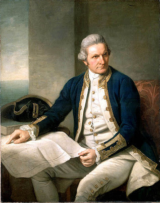
Near Nowra on the south coast of New South Wales is the harbour of the Australian Capital Territory, Jervis Bay. Captain James Cook (1728-1779)(bio here) originally sighted the bay and named St George's Head on St George's Day April 1770. Cook called Point Perpendicular (today's Lighthouse site) 'Long Nose'.

Today the safe harbour is known as Jervis Bay after the British Admiral John Jervis (1735-1823)(bio here). It was named in 1791 by Richard Bowen (1761–1797)(bio here) who had served under Jervis. George Bass (1771-1803)(bio here) visited Jervis Bay when he surveyed the South East coast of Australia in 1797.


Captain James Cook
Wikipedia photo (here)

As was usual with colonial expansion, in 1822 Traditional Owners were quickly displaced when Alexander Berry took up the land in the Shoalhaven area. They were (moved) to the 'Wreck Bay Aboriginal Reserve'. Smallpox and syphilis soon significantly reduced the local Aboriginal population. By 1932 only 50 Aboriginals were recorded as living at the 'Reserve' on Wreck Bay.


King Mickey of Kiama with King Billy of the Shoalhaven.
Kiama local history weblog (here)

In the 1860's the ill-Fated Cape St George Lighthouse was raised with concrete blocks made on site (link here). Unfortunately the Lighthouse was doomed from its beginning. Official bungling, lack of supervision and poor location (possibly the totally wrong location) hampered the visibility of the light to ships on the northern approach to Jervis Bay and failed to warn of offshore reefs. The Lighthouse operated less than 40 years at which time it was unceremoniously destroyed. In 1899 The Point Perpendicular (Capt. Cook's 'Long Nose') Lighthouse was established (in an appropriate place this time)(here).


What remains of the Cape St George Lighthouse.
Wikipedia image (here)

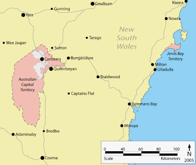
The Federal Government purchased the area from the New South Wales Government in 1915 to allow the new Federal Capital of Australia access to a seaport. It was however (and remains) administered as if it were a part of the Australian Capital Territory.


Map of the Federal Territories.
Wikipedia image (here)

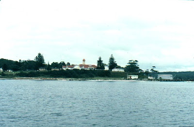
This was the stage for the Jervis Bay Territory to become the 'cradle' of our present day Royal Australian Navy. In 1911 Captain's Point Jervis Bay Territory on the south coast of New South Wales was chosen by Federal Parliament as the site for the Royal Australian Naval College. The Federal Parliament decision for Jervis Bay was based on the locations proximity to the new Federal Capital Territory and the fact that it is a natural safe harbour.


HMAS Creswell from the sea.
Wikipedia image (here)

By 1915 the main college buildings were complete. The college at Captain's Point was renamed HMAS Creswell after Sir William Rooke Creswell (1852- 1933)(bio here). Creswell was a colonial naval officer who wanted to see an independent Australian Navy and he was instrumental in achieving just that. The navel college provides basic and leadership training to officers in the Royal Australian Navy.
Creswell is on the Australian Heritage Commission's National Estate register as of 1981.


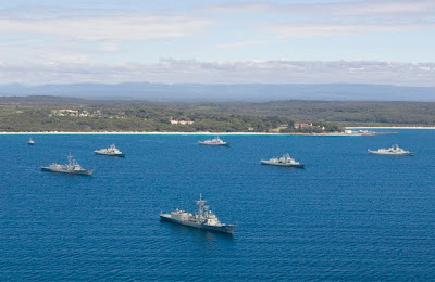
Royal Australian Naval ships at anchor in the Bay.

The Jervis Bay Territory is however, and contrary to popular belief, NOT a part of the Australian Capital Territory. It is however a territory of the Commonwealth of Australia. Jervis Bay has always been a separate Commonwealth territory and at 67 square kilometers (26 square miles) Jervis Bay is Australia's smallest territory.

 A few more facts... The laws of the ACT apply to the Jervis Bay Territory and the ACT Government provides school teachers and Australian Federal Police, Car registration, electoral boundary (Fraser), taxes, etc.


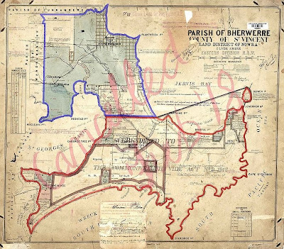
Parish map before resumption by the Federal Parliament.
Photo Wikimedia commons (here)

There are three villages in the Jervis Bay Territory. Jervis Bay Village (pop. 250), Greenpatch (pop. 30) and Wreck Bay Village (pop. 215). Over 90% of the territory is legally recognised as Aboriginal land with a community based at Wreck Bay in the Booderee National Park (link here). There are three small lakes within the territory: Lake Windermere (31 hectares/76 acres), Lake Mckenzie (7 hectares/17 acres), and Blacks Waterhole (1.4 hectares/3 acres).

Finally... in the late 1960s a nuclear power plant was planned...
the project did not proceed.

There is a good map of the Jervis Bay Territory (here)(pdf)
Jervis Bay is a lovely place to visit (website here)
The wreck Bay (Aboriginal) Community Council website is (here)
HMAS Creswell website (here)

View Larger Map

Sunday, May 30, 2010

WESTBOURNE WOODS

Canberra's first arboretum (info here) was established at Westbourne Woods in the Canberra suburb of Yarralumla. In May 1913 horticulturalist Thomas Charles George Weston (1866-1935)(bio here) was put in charge of the afforestation of the new city of Canberra.

The establishment of gardens, parks, and plantations (post here) were to be Weston's responsibility whilst at the same time propagating for and establishing a forestry industry in the area of the Australian Capital Territory.

Weston had to overcome the remoteness of Canberra's location, infertile soils, windswept plains and rabbit infestation when he began establishing plants suited for Canberra's developing landscape. He also wanted to reserve all hilltops around Canberra preserving their tree cover enabling the collection of native seed.


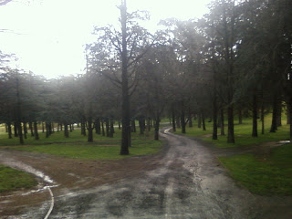
Westbourne Woods.
Image environment.gov.au (here)

Weston established the Yarralumla Government Nursery complex the same year. Weston also tried to ascertain which species of trees were the most appropriate for the Canberra climate. Westbourne Woods, which covers 120 hectares (296 acres) was named by Canberra's architect Walter Burley Griffin (1876-1937)(bio here) and is shown on his 1917 Canberra plan.

The woods were an experimental planting of various exotic species on a site chosen by Weston for it's relatively good soil, permanent water supply and the expectation that one day it's location might make it a public park.


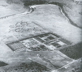
Yarralumla nursery 1925
Image Wikimedia Commons (here)

In 1914 the holes to plant the tree's of Westbourne Woods were created using explosives. Weston theorised that the fragmentation of the ground from the explosion would be more beneficial to the plantings than hand-dug holes.  More than 200 different species of conifers, exotic hardwoods and native Australian trees were planted, between 1914 and 1918. By 1920 planters had established 44,900 exotic trees. The Arboretum provided the 12 year old cedars in 1926 that were planted in front of Parliament House for instant effect on the occasion of its opening in 1927.

In 1945 Westbourne Woods was transformed into a golf course in an attempt to conserve the woods. Fairways were cleared and grassed and water was to be supplied by the Molonglo River and later by the new Lake Burley Griffin that was to be filled in 1963. Many of Canberra’s street trees were chosen because of their success in early plantings in Westbourne Woods. The woods are still used occasionally as a source of propagation material by Yarralumla Nursery.

Westbourne Woods is listed on the ACT Heritage Register.


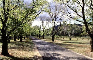
A view into Westbourne Woods.

The Glenlock Cork Oak Plantation was also one of Weston's many plantings (post here)


View Larger Map
Saturday, May 29, 2010

BLACK MOUNTAIN QUARRY

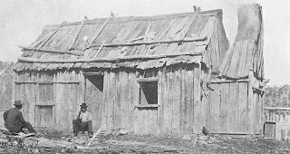
The original settlers of the 'Limestone Plains' (present day Canberra) came to the new territory with basically only their flocks of sheep and small herds of cattle. Upon arriving to establish a 'station' or 'run' tents were used by the new colonists as accommodation until such time as slabs of timber were split and used to erect 'slab huts'.


Slab Hut - Wikipedia article (here)

Native timbers of the area were used for housing, stockyards and outbuildings. These huts were replaced over time by more substantial timber houses and sometimes of pise' (rammed earth) like Rose's Cottage (post here) at Isabella Plains. The more substantial homesteads, buildings and church were built of stone.

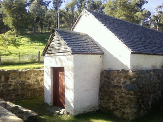
The Duntroon Dairy (post here) built  in 1832 was the first stone building on the Limestone Plains. It was made of material collected from the adjacent Mount Pleasant. In 1833 the owner of the 'Duntroon Estate' (post here) Robert Campbell (1769-1846)(bio here) ordered a stone dwelling be built on his land. He called that dwelling 'Limestone Cottage'.


Duntroon Dairy.

The nearest settlement in the 1830's was many weeks journey through rugged bush land with many water crossings along the way. The road (track) south from Sydney that was established by convict labour was not appropriate to carry heavy loads. Early settlers had no choice other than to be self sufficient in their appropriation of building materials.

Campbell used convicts and stone masons he employed from Sydney and built 'Limestone Cottage' using local stone to create an imposing building. The stone could have come from several locations including Mount Ainsley (post here), Kensendorlffes quarry,  Red Hill quarry or the Black Mountain Quarry. The small colonial quarry on the eastern slopes of Black Mountain provided sandstone building blocks to early structures on the 'Limestone Plains'.


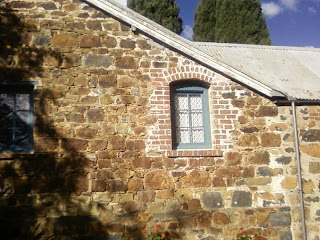
Blundell's Cottage wall.

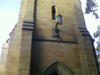
Between 1840 and 1845 the quarry supplied stone for the St Johns Anglican Church (post here) and schoolhouse paid for by Robert Campbell and built on land donated by him to the church. He and family members are buried there. 'Blundell's Cottage' (post here),
a small stone cottage on 'Duntroon' was built about 1860.


The stone of St John's Church

Today the area at the face of the quarry has Australian National University buildings on it and is not open to the public. The photos below are pretty poor because the weather was wintry and it was pouring rain.


Towards the rock 'face' of the quarry.


Old Machinery over a bunker. (rain blurred photo)


A pit in front of the bunker.


Further down the hill?


View Larger Map

Friday, May 28, 2010

'CANBERRY'

The first sheep station on the 'Limestone Plains' was established in 1824 by Joshua John Moore (1790-1864)(bio here). Moore became the first pastoralist of today's Australian Capital Territory when he was granted a ticket-of-occupation for over 2000 acres (over 809 hectares) on the newly discovered 'Limestone Plains' (todays Canberra).

An overseer and a number of Convict stockmen of Moore's constructed 'slab huts' and stockyards on Acton Peninsular at the base of Black Mountain. The property was originally called 'Canberry' after the Aboriginal word for the area. Today's National Capital of Canberra is named after this word meaning 'meeting place'.


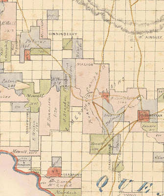
1843 Map showing Canberry
Wikipedia image (here)

Robert Campbell (bio here) established the second station in the area when his overseer John Ainsley (post here) a former convict then 'ticket of leave' man established the 'Duntroon Estate' (post here) for Campbell a year later.

In 1826 Moore applied for an extra 1000 acres (404 hectares) of land extending his holdings on the Limestone Plains. The 'Terror of Argyle' John Tennant (post here) who had been a convict assigned to Moore escaped in 1828 and became Canberra's first bushranger.

Canberry Station's expanse inluded the peninsular of the present day National Museum of Australia (homestead site), the Civic Centre (CBD), the Australian National University and portions of the Molonglo Plain (present day Lake Burley Griffin).

Joshua Moore was an absent landowner who never resided on his station and in 1843 during a depression, he sold Canberry to Lieutenant Arthur Jeffreys R.N., son-in-law of Robert Campbell. Jeffreys renamed the property 'Acton' and built the first substantial dwelling known as 'Acton Homestead'.


Drawing of Acton Homestead
Photo NLA (here)

Acton Station was the first station resumed by the establishment of the Federal Capital in 1911. A temporary workers camp was established on the site whilst Acton Homestead housed staff coordinating the development of the new National Capital. Charles Scrivener (post here) also occupied the homestead during his survey of the capital site.

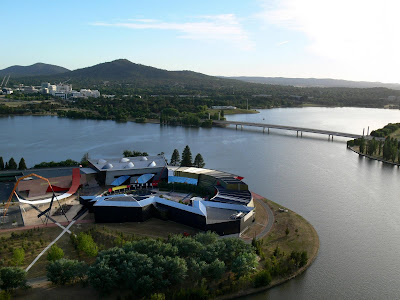
Acton homestead was demolished in 1941 to provide a site for the Canberra Hospital (post here). The hospital was demolished and the site of Acton Homestead is now the home of  the National Museum of Australia (pictured below).


Picture looking across Acton Peninsular to the Civic Centre.

MAP

View Larger Map

Thursday, May 27, 2010

WODEN STATION

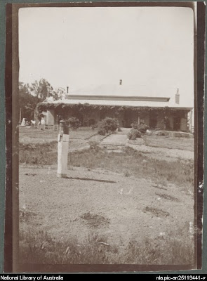
'Woden Homestead' is the oldest domestically occupied building in the ACT. It has a strong association with the early development of the region and with important figures in the region's history, including a lengthy connection with the Campbell family. The property still operates in a reduced capacity. I am still researching the property.


Woden Homestead (circa 1904-14)  Image NLA (here)

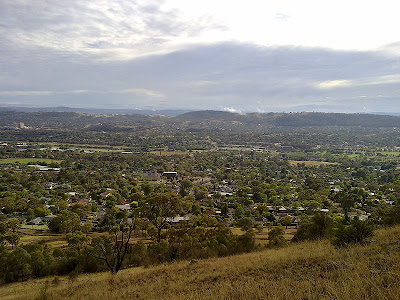
Woden Valley was a sprawling plain in a beautiful valley that nestles between Red Hill and Mount Taylor in the (now) Australian Capital Territory. It was once a plain consisting of large areas of stock fodder with scattered woodlands. The length of the valley was watered by the Creek (or Yarralumla Creek). The creek flows to it's junction with the Molonglo River below the Yarralumla Homestead (post here).


View from Red Hill across Woden Valley to  Mount Taylor.
Image Wikipedia commons (here)

The Woden Valley was owned by Dr James Murray who purchased 2,500 acres (1,012 hectares) of land west of the 'Limestone Plains' in 1837 that was destined to become Murray's Station .  Murray named the property after either the Old English or Norse 'God of War' ('patron of learning' or 'God of wisdom)'. He was reportedly quite a studious man and his  lifetime pursuit. was the 'seeking of knowledge'.

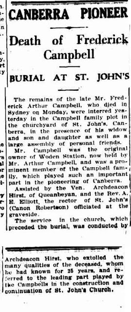
Obituary on the left (Canberra Times 23 Dec 1931).

When the Woden Valley was resumed for the new Federal Capital of Australia the area was in the possession of Yarralumla Station's owner Frederick Campbell (post here). Frederick Campbell is buried at St Johns Anglican Church (post here).

Woden Valley today is a town centre of Canberra, the name taken from the original nearby homestead and station. During the 1960's the area was quickly covered by suburbia established for the growing population of the National Capital.

The Woden Valley became the first residential development outside of the central Canberra area (Limestone Plains) and set the pace for the City of Canberra's future expansion into the plains of the Australian Capital Territory. The Valley now boasts 13 (inner south) suburbs arranged around the Woden town centre and has a population of approx. 32,000.


View from Mount Taylor across the Woden Valley to Red Hill.
Photo Wikipedia (here)

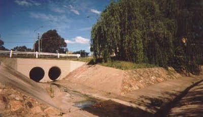
Today the creek is a stormwater channel. It emerges through large stormwater pipes in the Woden Valley suburb of Mawson before flowing  along through a large stone and concrete channel until it leaves suburbia. In the 1960's and early 1970's the open and accessible storm water channel and pipes were a childhood venue for bike riding and exploring. The creek where todays Marist College (post here) football ovals are was a flat piece of swampy ground perfect for catching frogs and tadpoles.


Drains entering the creek at Royal Canberra Hospital
(Woden Valley Hospital).

Whilst Canberrans were celebrating Australia Day in 1971 a flash flood surged through the Woden watercourse and engulfed Yarra Glen, a road intersection the drain passes. People were washed away and others were pulled from more than a dozen cars (including my future wife and family) that were swept off the road into the raging torrent. The creeks flow was reportedly increased by excessive stormwater runoff from suburbs that 10 years before had been sheep paddocks and scattered woodland. The flood killed seven people by drowning or injury.

THE WODEN STATION

View Larger Map

WODEN VALLEY MAP

View Larger Map

Wednesday, May 26, 2010

YARRALUMLA WOOLSHED

'Canberra... a good sheep station spoiled.'

It was said for many years that Australian's or more specifically the Australian economy 'rode on the sheep's back' and the Australian National Capital region was no exception to that saying. Large sheep stations were established on the sheltered, well watered and fodder covered plains of Duntroon (post here), Klensendorlffe's (post here), Springbank Station (post here), Ginninderra Station, Woden Station, Tuggeranong Station (post here), Lanyon Station (post here), in the Molonglo Valley (post here), Cuppacumbalong (post here) and others beyond the Murrumbidgee River and on the Monaro (post here).


Parliament House with sheep grazing in front (circa 1941)
NLA image (here)

The area at the time the 'Territory for the Seat of Government' was established in 1911 held (recorded) 224,764 sheep and the export of the areas wool helped evolve the Australian economy. In 1909 Frederick Campbell a descendant of Robert Campbell (post here) built a 20 stand woolshed on his property 'Yarralumla' (post here). He was also one of the prominent landowners of the area to support the Limestone Plains (Canberra area) bid to be the site of the new Federal  Parliament of Australia.

Yarralumla was at this time a 40,000 acre property (16,000 hectares) that supported the grazing of tens of thousands of sheep. Drought breaking rain in 1902 brought prosperity and facilitated the building of an appropriate 'shed' for a flock a property as rich as Yarralumla could sustain. The shed then handled the annual shearing of the Yarralumla flock for the next eight wool seasons. The first property resumed by the new Federal Territory on the Limestone Plains was 'Canberry Station' in 1911 and Yarralumla Station the following year.

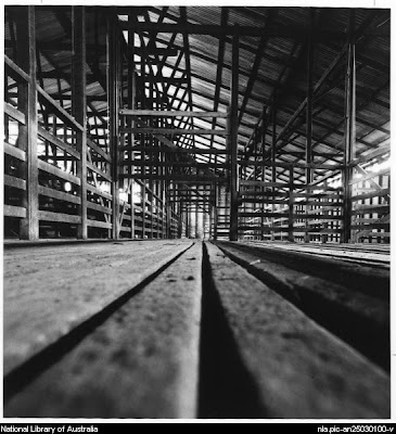
Inside the woolshed  


NLA image (here)


In 1912 the woolshed was being used for storage of supplies to support the construction of Canberra’s main sewer (post here) and other public works. Later the shearing shed was partitioned with galvanised iron to form sleeping areas and it housed unmarried Canberra building labourers. In 1917 the shed was re-opened for shearing and operated successfully for the next 47 years ceasing operation in November 1964. Yarralumla Station went on to become the official residence of 24 Australian Governor Generals so far.

No longer equipped with the machinery necessary to operate, the shearing shed remains, now silent below Scrivener Dam (post here). In the 1970's my sister and I were members of the Canberra Lakes Pony Club that was located at the woolshed. The Government agistment for our horses was at the back of the Canberra suburb of Lyons and it was a short ride to the 'old woolshed' and the Molonglo River beyond. Today the Yarralumla Woolshed is the home of the ACT Equestrian Association which I think is quite appropriate.Their website is (here).

Planning a bush dance?.. the Yarralumla Woolshed can be hired from the ACT Government for functions and events. Daily hire is $500, deposit is $500:

(Conditions of hire and fees here (pdf)

(ACT Government Yarralumla Woolshed page here)

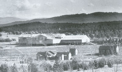
Yarralumla Woolshed (circa 1925)

Photo: Wikipedia commons (here)

The view from the front today.


The rear of the shed showing covered holding yards.


MAP

View Larger Map

THE CAUSEWAY HALL

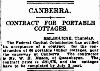
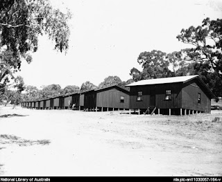
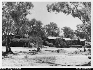
During the mid 1920's Canberra needed to house more families working on the construction of the new Federal Capital. A settlement of 120 wooden cottages were built for workers near a causeway that was used to carry trains across the nearby Molonglo River.


Sydney Morning Herald, Friday 20th March 1925 NLA Trove (here)

Note: The railway causeway itself was operational from 1917 until 1922, when it was washed away by a flooded Molonglo.

On the 20th September 1928 this new residential area of Canberra was gazetted as 'The Causeway'.  HM Rolland, the designer of the cottages also designed the cottages at Westlake and Acton. The cottages were based on the same style as the earlier camp at 'Westlake' (post here) and were of a wooden construction. The buildings were described simply as 'portable timber cottages'.

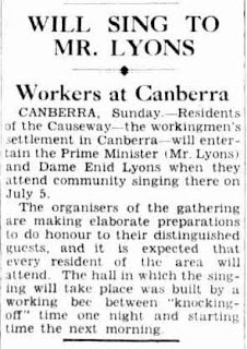
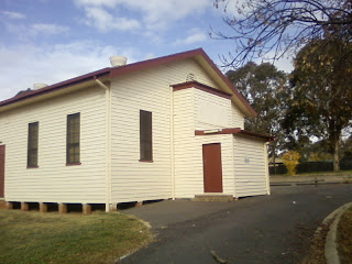
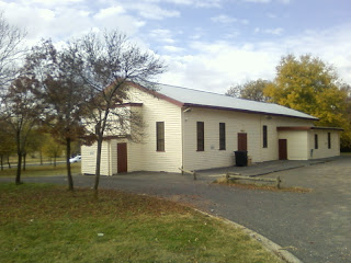
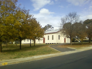
The young City of Canberra at this time still had no purpose built venue for community gatherings or entertainment. In 1926 with voluntary labour and materials supplied by the Federal Capital Commission the first purpose built community hall was erected at the Causeway. Over the years the Causeway Hall was used as a picture theatre and dance hall. Concerts and boxing matches were held there and local entertainers performed for the whole of Canberra for several years, then for the residents of the Causeway and later the nearby new suburb of Kingston (here).


The Argus (Melbourne) 27/6/1938

The Causeway Hall has the classic features of a turn of the century Australian hall. It has an entrance vestibule, high windows, ticket room, and a staircase leading to a projection room. The hall was (and remains) a venue for many early Canberran community activities and is the last substantial building dating from the original 1920’s Causeway settlement.

In the 1950's housing at the Causeway and Westlake was considered sub-standard and the wooden cottages were replaced in the 1970's at the Causeway with standard government brick dwellings. The Causeway Hall now sits as a reminder on a grid of empty streets and government brick housing that I believe will be demolished and re-developed.

The development of the 'Kingston Foreshores' (here) that is currently underway on the foreshores of Lake Burley Griffin is introducing many multi-level apartment buildings and units to the Causeway's landscape. A landscape that has become very desirable and valuable. The development will soon engulf the Causeway...

ACT Heritage Council assessment can be found (here)(pdf)
Canberra Times article - fate of the current residents (here)
Canberra Times article - current residents feelings (here)

.


View Larger Map

Tuesday, May 25, 2010

CANBERRA'S VANISHED SUBURB


"Over the hill and down into the hollow
Theres a path we all follow
To this place we still call home"
Plaque erected by Westlake children at 'Westlake'

In the early 1900's Walter Burley Griffin (1876-1937)(bio here) named an area of  'Klensendorlffe's Paddock' (post here) near the soon to be built Parliament House, 'Westlake'. At first the area was used to house workers building the new city of Canberra in camps consisting of tents. One camp was established in the 'hollow' of a natural saddle of the area's landscape called the 'Gap'.

This natural feature led down to the nearby Molonglo River and is thought to be an Aboriginal (post here) pathway from Black Mountain to Tuggeranong (post here). An old road (circa 1850's) from the nearby quarry was said to have been established on an existing Aboriginal pathway. Aboriginal scarred trees (post here) at Westlake and reported stone artifact scatters on Stirling Ridge by a Ngunawal  Elder confirms sustained habitation of the area by Aboriginal people.

Cottages were built in 1923 and occupied in 1924, for married tradesmen building the infrastructure for the new Federal Capital of Australia. The cottages were built by the Federal Capital Advisory Committee and the 'suburb' Westlake was born. Many Families lived and grew up in the sixty one (61) cottages that made up Westlake over a period extending for fifty years. These families of Westlake are well remembered and well documented.


The first cottages constructed at Westlake
NLA image (here)

It was said that Australia's 'great depression' of the 1930's and the financial constraints of World War Two prevented the building of more substantial replacement dwellings (and possibly the area's continued existence) for residents of the Westlake workers camp. The 'camp' was served by a Community Hall and a social history was developed over time by the close knit community.

Today the workers camp at Westlake has literally vanished after concerted efforts by the Government to remove all signs of it's existence as an area of prior residence. The housing was removed in the 1960's and soil from the excavation of Canberra sewer trenches (circa 1920's)(post here) was spread out over the cottage sites.


Established cottages
NLA image (here)


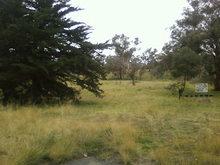
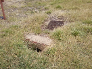
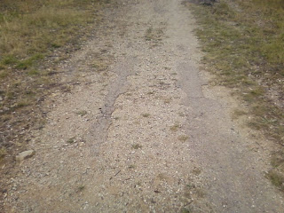
The physical site is now an open 'paddock' with native plantings established over the years and natural regeneration of the 'native bush'. Though the area is slowly being reclaimed by nature, hints remaining of the area's time as Canberra's first 'suburb' are all around. Old strips of bitumen on a track that once was a road (now a degraded track), a drain on the 'paddock' a remnant of the cottage's drainage system and the area is sprinkled with aging exotic trees.

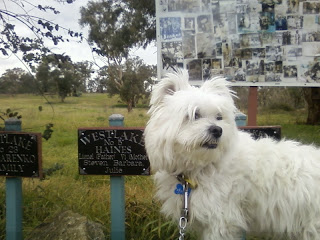
Attempts have been made to provide signage to the history of the Westlake settlement and there are several plaques and numerous signposts showing the cottage placements that give a perspective of how the camp once looked and a glimpse into the lives of Canberra's first real residents. I particularly enjoyed reading the brief reminiscence of a (now grown) child of westlake saying something to the effect of  'After school and at every opportunity we went down to the (nearby) Molonglo river and never liked wearing shoes...'

Looking at the Embassy studded area today I would say a "cottage" at Westlake today would be worth a million dollars. The old Westlake workers camp is an interesting area for a stroll.

For Compehensive information I highly recommend Canberra Historian Ann Guglers websites...

Hidden Canberra: http://hiddencanberra.webs.com - this is her major site

Glimpses of Canberra: http://canberraglimpses.webs.com - then she decided she had more to say

Early Canberra: http://www.earlycanberra.webs.com - and more

Canberra Camps, Settlements & Early Housing: http://canberracamps.webs.com - as above!

Canberra Electoral Rolls: http://canberraelecrolls.webs.com which she transcribed herself.


You will know your in the right spot.


A view as you enter the Westlake area.


The layout around the area is provided by signage.


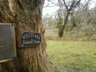
Haine's Creek


The drains


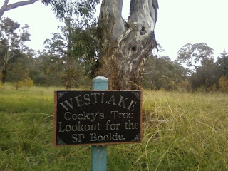
A bit of Canberra's horse racing history apparently...


Remnants of an old bitumen road


Through the gap and down to the river (now Lake Burley Griffin)


Scruff... (my partner in crime)


View Larger Map
Located at the end of Empire Circuit, Yarralumla. 

KLENSENDORLFFE'S LAND

In 1839 a land grant was made to William Klensendorlffe (1789-1861) of a parcel of land on the 'Limestone Plains' (modern day Canberra). Klensendorlffe was a German free settler arriving in the colony in 1818 after serving in the British Navy. Since the early 1900's Klensendorlffe land has been the political heart of Australia.

From early times the area was known as 'Klensendorlffe's Land' and was marked as such on maps of the era. Klensendorffe constructed a large two story stone cottage on the Molonglo River flats and called it 'Elizabeth Farm' presumably after his wife Elizabeth. It is known that his land's included the present day Parliamentary Triangle, Stirling Park and the embassy district of the Canberra suburb of Yarralumla.

'Klensendorlffe's Paddock' was described as 'Principally of gently undulating land timbered with gum (box), ironstone and slate outcrops. It supports three sheep to the acre. The green timber is not suitable for building but satisfactory for fencing.'
AW Moriarty 1912

Not much else is known about Klensendorlffe other than he was once described as a 'litigious man' and was known to be unkind to the convicts working for him. The drought in the early 1840's forced Klensendorlffe into bankruptcy in 1847.


The Maitland Mercury & Hunter River General Advertiser 31 Oct 1846

'Elizabeth Farm' was then tenanted from 1854 until 1924 by the Kaye family and all that remains is an old pine tree where the gate once was and the memories of the Kaye families descendants.
The Federal Capital Territory was declared in 1911 and by 1913 tenant farmers were told that they could remain until the land was required by the Commonwealth. For a time the farm cottage was tenanted by construction workers and the leased land was reduced to four acres (1.6 hectares) around the farm cottage.

According to Canberra Historian - Mrs Patricia Frei: http:www.canberrahistoryweb.com -  Klensendorlffe's stone Cottage now rests under the waters of Lake Burley Griffin. The Briar Cottage site which was part of the property is now the home for the Southern Cross Yacht Club. Old and new Parliament House, many embassies, the Canberra suburb of Yarralumla, Lake Burley Griffin and Canberra's lost suburb of 'Westlake' now sit on what was once... 'Klensendorlffe's Land'.

NOTE:  Originally the land was owned by the Ngunnawal ? (govt accepted traditional owners) / Ngambri ? (post here) / Ngarigu ? (post here) people for many thousands of years.

A history of Sterling Park is can be found via Canberra Historian - Mrs Patricia Frei: http:www.canberrahistoryweb.com -

View Larger Map

Monday, May 24, 2010

SCRIVENER'S SURVEY HUT

The present site of the Australian Capital Territory and it's city of Canberra was decided after an extensive search.  The site was chosen in 1908 as a result of survey work done by the Government Surveyor Charles Scrivener.


Charles Scrivener (1859-1923)(bio here)

He surveyed numerous sites for the construction of Australia's new capital, finally settling on Canberra.  John Gale, the publisher of The Queanbeyan Age (1831-1929)(bio here) and Federal politician King O'Malley (post here) campaigned strongly for the Canberra area.

In December 1908 Scrivener was chosen to determine the best city site and water-catchment territory for the new capital. Scrivener forced his small team 16 hours a day completing  the survey in two months, an amazing feat when one looks at the outlying topography of the Australian Capital Territory. (there is a good read (here pdf) about the original survey showing detailed maps.


Canberra Contour map
NLA image (here)

He suggested a boomerang-shaped territory of 1015 sq. miles (2630 km²) enclosed by the Cotter River, Queanbeyan and Molonglo river catchments. The competition for the design of Canberra that was won by Walter Burley Griffin was based on Scrivener's survey. Scrivener was described as 'a long, lean man with a kindly hairy countenance... a taciturn man' (temperamentally disinclined to talk).

In 1910 Scrivener was appointed first director of Commonwealth lands and surveys and he worked closely with Walter Burley Griffin in Canberra's design (though he often disagreed with him). Scrivener retired in 1915. The first Surveyor's Camp of Scriveners' comprised of 16 tents, a small timber slab skillion roofed building (kitchen) and a small surveyor's hut constructed from concrete with a curved corrugated iron roof. The small surveyors building now sits undisturbed below New Parliament House.


Scrivener reading maps in 1911 (in white coat).
Australian National Archives source (here)

The preserved building dates from 1909 and housed e original survey documents of the ACT. The 'hut' has the honour of being the first permanent Commonwealth building in the ACT. Scrivener Dam that holds back the Molonglo River and forms Lake Burley Griffin is named after Scrivener, and if you read his bio (here) I think naming Lake Burley Griffin's Dam after him is somehow quite apt.

There is a brief history of the border survey from act.gov.au (here)
Scrivener's  May 1909 report at the Canberra History Group (here)


 First view


ACT Heritage plaque at the door.


The Surveyors Hut is located at the base of Capital Hill.
   
View Larger Map
History lost through lack of funding

  The following ABC article laments the possible loss of many historical audio visual records that are waiting for digitising into modern fo...